This work combines social media and sensor data to measure the road safety in the Pittsburgh Metropolitan area.
- “An empirical study of combining participatory and physical sensing to better understand and improve urban mobility networks,” in Transportation Research Board (TRB) Annual Meeting, Washington, DC, 2015.
![[PDF]](http://www.wiomax.com/wp-content/plugins/papercite/img/pdf.png)
![[PPT]](http://www.wiomax.com/wp-content/plugins/papercite/img/ppt.png)
![[DOI]](http://www.wiomax.com/wp-content/plugins/papercite/img/lnk.png)
![[Bibtex]](http://www.wiomax.com/wp-content/plugins/papercite/img/bib.png)
@InProceedings{Xie2015,
Title = {An empirical study of combining participatory and physical sensing to better understand and improve urban mobility networks},
Author = {Xiao-Feng Xie and Zun-Jing Wang},
Booktitle = {{Transportation Research Board (TRB) Annual Meeting}},
number={3238},
PDF={http://www.wiomax.com/team/xie/paper/TRB15LBSN.pdf},
PPT={http://www.wiomax.com/team/xie/demo/TRB15_demo_BigData_UrbanInformatics.pdf},
LNK={https://trid.trb.org/View/1337999},
Year = {2015},
Address = {Washington, DC}
}
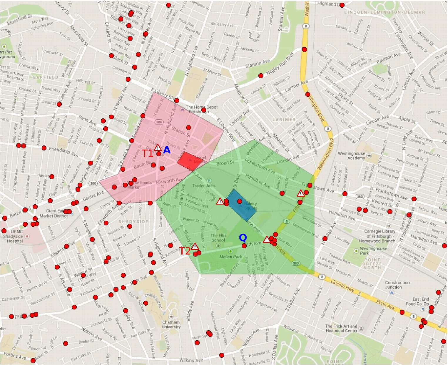 The collected data contains 3,399,376 checkins of 74,658 users at 2,198,572 venues. The temporal patterns of the checkins for “accident” (as the sub-topic) discloses that people should pay more attention to avoid accidents during the morning rush hours, especially for the peaks.
We found that the spatial checkin distribution is surprisingly broad for the “accident” sub-topic. This implies the importance of further improving the urban road safety (which might be addressed in the emerging autonomous and connected vehicle technology).
[Case Study] Road Safety: Data Analysis: City of Pittsburgh